

THE E. RICHARD HART COLLECTION
Author/Historian Richard Hart made a major impact in the Sinixt’s case against extinction in British Columbia/Canada. Richard kindly donated hundreds of documents and files to the ICRC.
-

ARTICLE
Richard’s work featured in Cartographica.
-

ARTICLE
Mapping the Transmississippi West
-

ARTICLE
A 2021 article by Richard regarding the Ross maps.
-

ARTICLE
Mapping Indigenous Knowledge in the Digital Age
-

ARTICLE
Importance of Indigenous Cartography article.
-

DOCUMENT
Lakes Area Place Names Chart.
-

DOCUMENT
Placenames in Columbia/Arrow Lakes.
-

DOCUMENT
Sin natchegge River information.
-

DOCUMENT
Snayckstx Place Name Map
-

DOCUMENT
Interim Report on the Sinixt Place Names Map by E. Richard Hart, 2021.
-
DOCUMENT
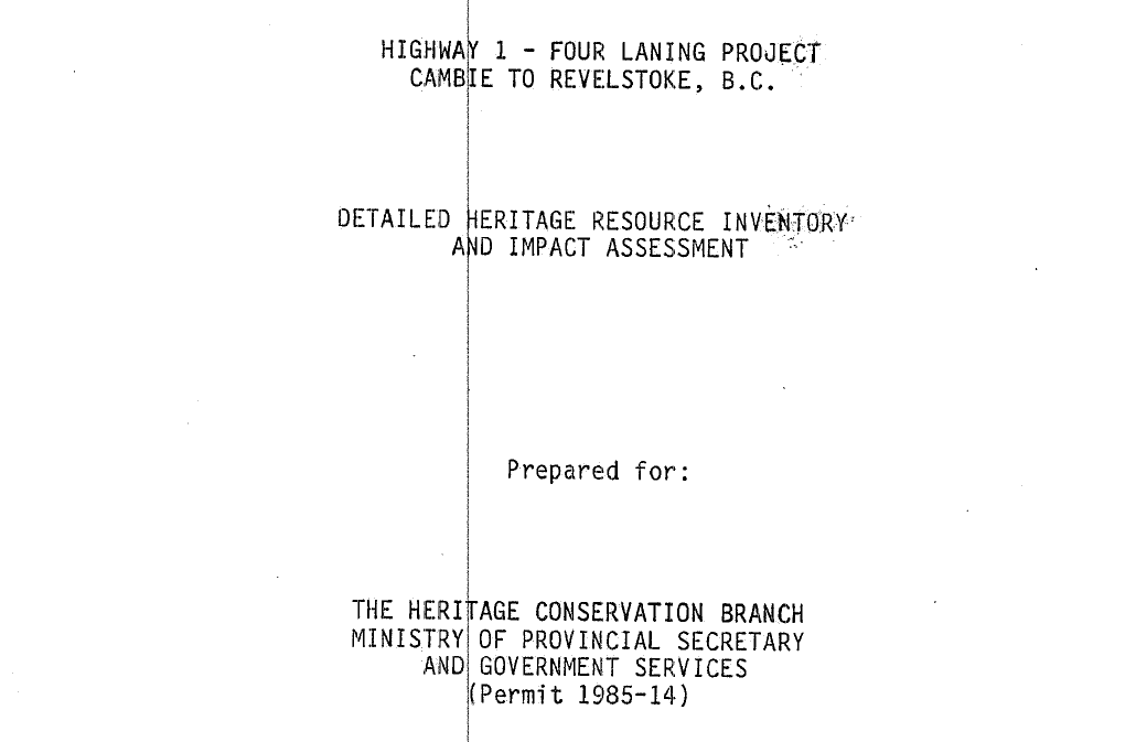
Highway 1 - Four laning project Cambie to Revelstoke, B.C. Detailed Heritage Resource Inventory and Impact Assessment.
-

DOCUMENT
1985 - Lake Indian Ethnography and History
-

DOCUMENT
Linguist Tony Mattina’s numbered spellings.
-

DOCUMENT
Place names locations for the Sinixt
-

DOCUMENT
Place names of the Sinixt, from Laura Stovel’s “Swift River”
-

DOCUMENT
Information and a map regarding Northern Okanagan, Lakes and Colville, from a document by Dorothy Kennedy and Randall T. Bouchard.
-

DOCUMENT / MAPS
Hudson’s Bay document and maps.
-

HISTORIC PHOTO
Stovell Historic Photo of Tepees at Nakusp Point.
-

HISTORIC PHOTO
“Tepees at Nakusp Point.” No date. Lodges among trees. In front of lodges is canoe upside down.
-

HISTORIC PHOTO
Mrs. David Capillo and son Abel, Burton
-

HISTORIC PHOTO
Native man, from Bert Herridge
-

HISTORIC PHOTO
Native woman
-

HISTORIC PHOTO
Needles Indian Cemetery
-

INFORMATION
Swift River pertinent information
-

MAP
Upper Columbia up to the end of the fur trade era document, which includes a map and Sinixt place names.
-

MAPS
Ancestral Sinixt routes and place names from Laura Stovel’s “Swift River”
-

MAPS
From the publication “First Nations’ Ethnography and Ethnohistory in British Columbia’s Lower Kootenay/Columbia Hydropower Region.”
-

MAPS / PLACENAMES
Sinixt maps and place names
-

PICTOGRAPHS
Trout Lake pictograph
-

PICTOGRAPHS
Pictographs near Cape Horn
-

PICTOGRAPHS
Indian writing near Cape Horn
-

PICTOGRAPHS
Indian Pictograph on Cape Horn, Upper Arrow Lakes, Nakusp, B.C
-

PICTOGRAPHS
B.C. Pictographs without a location given.
-

PHOTO GALLERY
Photos from British Columbia.
-

PHOTO
Lake Slocan. Slocan Area. Bouchard and Kennedy (1985) provide spellings from Teit, Ray, Mobery, Dewdney, Palliser, and their own (from Mary Marchand, Julia Quintasket and Joe Barr). Mattina uses the spelling sɬw̓ qin, which seems to mean “top of spear.”
-

PHOTO
Bonnington Falls. Teit provided a place name for the falls, which were an important dividing line between Kootenay and Sinixt use of salmon–salmon could not get over the falls. Mattina could not provide a spelling for this word. Teit called it “portage or carrying place for canoes.” The name may not be Salish which would explain Mattina’s conclusion. Teit’s spelling is ntsa̷kuł̷txu. The village Teit described must have been between Bonnington Falls and the junction of the Slocan and Kootenay Rivers.
-
PHOTO
Mouth of Slocan River
-

PHOTO
Place where trout ascend to Slocan Lake. Teit and Ray provided spellings for this place. Mattina provided the spelling tqlʕickst. Bouchard and Kennedy concluded in their 1985 (98-99) that the name referred to trout. In their 2000 (170-171), they concluded the only place where trout ascended to Slocan Lake was Wilson Creek.
-

PHOTO
Mouth of Springer Creek. Sinixt village on Slocan Lake according to Teit and Ray. Mattina took the spelling they provided and adjusted the spelling to syx?ilx. Bouchard and Kennedy (1985,99) reported that Mrs. P. Cooper said her father reported a village of 60-70 “‘Colville’ Indians lived at the mouth of Springer Creek, at the southeast end of Slocan Lake, but they left in 1896.”
-

PHOTO
Slocan River from Lemon Creek area.The Slocan River. Mattina provided a spelling from the words provided by Teit and Ray, but provided no meaning for the word, səntk’litkw. Bouchard and Kennedy also do not provide a meaning for the word, but identify a place on the Slocan River as being a location of prehistoric Sinixt settlement. It is worth noting that at Lemon Creek there are many pithouses and there has been considerable archaeological work.
-

PHOTO
The confluence of the Slocan and Kootenay Rivers. Near the junction of the Slocan and Kootenay Rivers was a village that was possibly seasonal. Mattina translates the spelling of Ray and Teit to səntk’litkw. Teit said the village was near the junction of the rivers. Ray said it was “on the north side of the Kootenay river about a mile from the mouth of the Slocan river.”
-

PHOTO
This Highway 25 bridge goes from Northport to the Sheep Creek drainage. The mouth of Goodeve Creek [formerly called Nigger Creek] is located at on the Columbia River opposite the town of Northport. Highway 25 crosses a bridge from the Goodeve Creek drainage to the town of Northport. Original spellings were provided by Bouchard and Kennedy (from Mary Marchand) and from the St. Regis Mission House Diary (Bouchard and Kennedy, 1985, p. 125). From those spellings Mattina provided the spelling nsəsk’wúlaʔxw, for which he provides no clear meaning. The mouth of Sheep Creek is located on the Columbia River slightly to the southwest of the mouth of Goodeve Creek. Highway 25 crosses a bridge from the Goodeve Creek drainage to the town of Northport. There was a Sinixt village in this location. Original spellings were provided by Bouchard and Kennedy (from Mary Marchand) and from two sources in the 1880s (Symons and Baldwin). Mattina said this was “an attested place name,” and gave the spelling as yumcn.
-

PHOTO
Looking through the Highway 25 bridge on the east side of the Columbia River towards the current town of Northport. Archaeologist David Chance said evidence of a Sinixt campsite was located just south of the bridge (in the area viewed here through the bridge). This is a site on the east side of the river just north of the town of Northport. Archaeologist Chance said Sinixt village remains were found just north of the Highway 25 bridge. Many sources provided names for this location, including Bouchard and Kennedy (from Marchand), Teit, Ray, Baldwin, and Elmendorf. Mattina looked at all the spellings and provided this spelling, ncəcr̓í̓sm, which he said meant “place with kingfisher.”
-

PHOTO
This photograph shows the land along the banks of the Columbia approximately three miles downriver from the town of Marcus. The site of the village identified by Ray (#59) probably would have been inundated by the raising of the river from the damming of the river further south. In his “Native Villages” report, Verne Ray said that the “lowermost” Sinixt village on the Columbia was “npəpkolaʹt’skin,” which was “two miles below the present town of Marcus.” (Ray, 1936, p. 124). He said this village was small in summer but larger in the winter. Sinixt and Scoyelpi met there and played games, he said, adding that the Kalispel also met there. Camas was gathered in the nearby Selkirk Mountains. Ray also said a Hudson [sic] Bay post was established about 3/4 of a mile upriver from this point, which led to the increase in size of this village and more trade. Mattina did not recognize this word, but gave the spelling as npəpk?lícqn. Ray (1936, 124) said another village, “kɩxkɩʹ'us,” was located one mile below Marchus “where the Dobson ferry formerly crossed. This site was below the high water line of the Columbia [R]iver and had to be evacuated before the rise of the water in the spring. “It was the largest winter village of the Lakes with an average population about 200.” Ray said that in Hudson’s Bay Company days [ca. 1821-1846], it was “more popular than #58. Mattina said he did not recognize this word, but gave the spelling as kxkiw̓s.
-

PHOTO
Shore of Columbia River banks at Marcus. Verne Ray (relying on information from graduate student William Elmendorf) identified a village that was located at the present-day site of the town of Marcus. Mattina provided the spelling ncəlc’l ítkw , and agreed with Ray that it meant “trees in the water.”
-

PHOTO
Bench on the east side of the Columbia River near the current town of Marcus (on the west side of river). Ray (1936, 124) said a village was located directly across the river from Marcus, “on the first banch above the river. It was a winter village that was populated from December to February, with “four or five families” remaining through the summer. He said the word meant “large grove of cottonwood trees near the river.” Mattina said it Ray’s spelling looked like a Sinixt word and gave a “wild guess” at the following spelling: aʔc?̓áckstcən.
-

PHOTO
The area on the west side of the Columbia River opposite Bossburg. Ray located a hunting camp directly opposite the town of Bossburg on the Columbia River. He said it was occupied in February for the purpose of deer hunting. He added, “From here a trail led into the hills to the north.” Mattina provided the spelling sntkɬɬxwiltn and said suggested the word meant something to do with a trail.
-

PHOTO
Basin along the Columbia River between Bossburg and Northport. Ray said that this location was occupied during March each year as a camp from which root digging could take place. It was located “between Bossburg and Northport.” Ray said the word meant “basin in the river bench.” Mattina said the spelling should be tɬtitk?s ?, and that the word related to “straight water.”
-

PHOTO
Today’s town of Malo. Ray (1936, p. 128) said that there was “a small settlement at the present town of Malo, Washingon.” He said that Malo was “about four miles northeast of Curlew [L]ake. It was a permanent camp where trapping, hunting, and trap fishing were possible.” Ray’s spelling for the word is ‘stɩxtɩɬu’stən” and seems to be substantiated by Mattina, but Mattina does not providwe a spelling.
-

PHOTO
Approximate location of village near Taghum. In their 2000 report Bouchard and Kennedy place nxa7xá7tsen near the current town of Taghum, but place a question mark after the place name. The name represented a village near the current town. Mattina gives the following spelling for the name, nxaˑxaʹtsən, but indicates it is the same name as #49, which Ray said was a camp “on the Kootenay River, opposite Nelson, at the edge of caribou hunting area.” So perhaps #88 should be removed and only #49 should be left in the area.
-

PHOTO
Christina Lake. Christina Lake. Freisinger provides a spelling for this location. Teit listed the place but provided no place name. Mattina provided the following spelling: ncəʔám. He said it referred to “water hitting a place.”
-
PHOTO
Across the Kettle River from Curlew. Present town of Curlew. Freisinger provided a spelling and Mattina adjusted it to səsqc̓ ín. The word was said to mean “‘split at the mouth.’ The town of Curlew, takes its name from the ‘split’ canyons on the west side of the town, south of the Kettle River.”
-

PHOTO
Kettle River from Curlew. Opposite Curlew. Freisinger says his word is “Having wild rose bushes.” The place seems to be opposite the town of Curlew. Mattina spells the place as Skekew’ílhpm.
-

PHOTO
Kettle River very near to Danville and the International Boundary. Freisinger lists this place as being downsteream from Danville, but from his map it is not clear that is upstream instead of downstream. Trisha: This number could be right on the international boundary line by Danville, thus handling the problem. The spelling Mattina uses is kmáʕtmqən. which he says means possibly “something [sic] on the ground on top” or “something broken on top.”
-

PHOTO
Current site of the town of Addy. Verne Ray said this was “reputedly a Lakes settlement at the present site of Addy, Washington.” Bouchard and Kennedy (1985) said Ray’s inclusion of this site was as a result of the work of Elmendorf. They provide evidence and reasons for discounting Ray’s site, including the government witness, Stuart Chalfant, in the Indian Claims Commission case. They seem to regard the site as a place occupied by Lakes after 1880. Ray said the word he recorded came from the Sinixt word for “crane.” Mattina says a correct transcription of this word might be sk?árxən.
-

PHOTO
Revelstoke/Illecillewaet River/Tonkawatla Creek area. This number on the map was said by Teit to be located in the Revelstoke/ Illecillewaet River/Tonkawatla Creek area. The spelling originally was attributed to Teit, and was adjusted by Mattina to skxíkcn*tcn. Others who provided related spellings were Boas and Ray. Bouchard and Kennedy, in their 1985 report provided related spellings from Sinixt-speaking tribal members Mary Marchand and Julia Quintasket. Teit reported in 1909 that this place was the “headquarters of a rather large band.”
-

PHOTO
Illecillewaet River. This place name came originally from Boas in 1900. Mattina adjusted the spelling to səlx?aʔítk?. Bouchard and Kennedy provide the definition of the name as “Big River.” However, Mattina could not explain the Salish source for this place name.
-

PHOTO
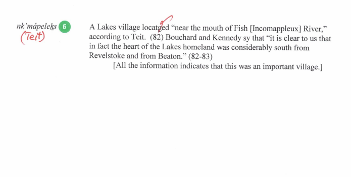
Mattina has the same word, nkmaplqs, for the Beaton/Comaplix/Incomappleux River area and for the Sinixt village which Teit said was located “near the mouth of Fish [Incomappleux River.”
-

PHOTO
Another shot of Beaton.
-

PHOTO
A third shot of Beaton.
-

PHOTO
Arrowhead. Mattina gives the spelling as qwəspíc’a? drawing on spellings by Teit, Ray and Bouchard and Kennedy (1985[from Mary Marchand]). According to Mattina, the term means “buffalo robe.” Mattina seems to say that Teit’s term is spelled correctly according to the Bouchard so-called “practical orthography,” an orthography that predates the easy availability of phonetic symbols (on word processors, for example). Mattina continues that the other two transcriptions in Bouchard and Kennedy also try to represent qwəspíc’a?. Layman, William D. River of Memory: The Everlasting Columbia. Collectors’ Edition. Seattle: University of Washington Press, 2006, p. 106 (in section drafted by Eileen Delehanty Pearkes) identified a Sinixt village in the area as being called“kwespits’a7 [Buffalo Robe]” by the Lakes. This may suggest that Fort of the Lakes was constructed at a site where the Sinixt had previously traded with neighboring tribes.
-

PHOTO
Arrowhead, photo 2
-

PHOTO
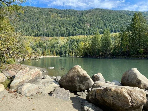
Northwestern end of Trout Lake, near where the Lardeau River enters the lake. The upper (northwesterly ) end of Trout Lake, which Bouchard and Kennedy (1985) described as a Sinixt “encampment at the site of the settlement of ‘Trout Lake City,’” which is also the location from whence a portage could be made to Upper Arrow Lake. Mattina provided a spelling of sənp̓?̓míp derived from an original orthography provided by Ray.
-

PHOTO
Location of Gerrard at foot of Trout Lake. Apparently a seasonal village near the upper (southeasterly) end of Trout Lake, near the town of Gerrard. Mattina may have provided the spelling ʔaks for this location (it is not clear he used this spelling and it is not like the spelling provided by either Teit or Ray).
-

PHOTO
Kuskanax Creek where it passes under the road entering Nakusp. Kuskanax Creek (just north of today’s town of Nakusp). Bouchard and Kennedy (1985) provide spellings from Moberly, Bissett, Dawson, Teit, Ray and their own from Mary Marchand. Mattina uses the spelling kwsxnaqs.
-

PHOTO
Kuskanax Creek Point. There was a Sinixt encampment at this point. One historic photo shows a sturgeon-nosed canoe here.
-

PHOTO
The bay at the town of Nakusp. Nakusp. Bouchard and Kennedy (1985) provide spellings from Dawson, Teit and Ray. Mattina provides the spelling nk?usp, but says it is a “plausible guess,” and provides no meaning.
-

PHOTO
Mountains to the east/southeast of Nakusp from Nakusp Point. It is unclear if Nakusp Point is the same as Kuskanax Creek Point.
-

PHOTO
South end of Slocan Lake. The head of Slocan Lake. [Trish has used the Teit/Ray spelling instead of Mattina’s.] Mattina has provided the following spelling: sənk’n ip. Teit referred to the village as being at the “upper end of Slocan Lake.” Bouchard and Kennedy call this the “head” of Slocan Lake. This seems to mean that they are talking about the southern end of Slocan Lake.
-

PHOTO
Cover page for Regina v. Richard Lee Desautel
-

PLACE NAMES
Place names and some notes.
-
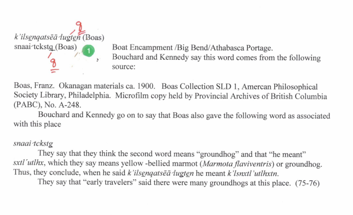
PLACE NAMES
Boat encampment.
-

PLACE NAME
Working place
-

PLACE NAMES
Revelstoke and area
-

PLACE NAME
Big water
-

PLACE NAMES
Beaton and more
-
PLACE NAMES
Lakes village
-

PLACE NAMES
Arrowhead
-

PLACE NAME
Upper end of Trout Lake
-

PLACE NAME
Village near Trout Lake
-

PLACE NAME
Seasonal village near Gerrard
-

PLACE NAME
Fosthall Creek
-

PLACE NAME NOTES
Extensive notes on place names
-

PLACE NAME NOTES
Extensive notes on place names